Geoinformation system "Road KHMAO-YUGRA"
JSC "Uralgeoinform", together with the Scientific and technical centre of the Road Department of KHMAO-Yugra, implements the project of creation of branch geographic information system (GIS) for tasks of management of the road. The project was started in 2007 as one of the first stages of implementation of the cooperation agreement made between the Roskartografiya and the government of KHMAO-Yugra in 2006.
GIS "Roads of Yugra" is one of the first components scheduled for the coming years GIS "KHMAO-Ugra" - the information system, which will combine the work of the various departments, agencies and other organizations of the County in a uniform field.
- the creation of a spatial database on the territory of KHMAO-Yugra;
- the creation of the integrated storage register of data on road facilities of KHMAO-Yugra;
- security in the framework of GIS "Roads of Yugra" access interfaces to other information systems of the government of the KHMAO-Yugra;
- providing spatial data storage, providing access to them by means of search and retrieval of data, conversion of data into various forms and formats; processing and analysis of spatio-temporal data;
- information-analytical support of work of the road Department in the area of economic planning;
- information-analytical support of decision tasks in the planning and implementation of measures for the development of the road network and keeping it up to standard;
- automating tasks the road Department associated with the formation of accounting documentation.
The system of "Roads of Yugra" is planned and developed with the perspective of creating GIS "KHMAO-Ugra", which will bring together the work of various departments and agencies of the County in a uniform field. The system - first implementation phase and the first component of GIS "KHMAO-Yugra". The creation of such GIS to date is vital and actively supported by the government of Russia, in particular in the framework of the "Strategy of information society development of the Russian Federation".
Designing a GIS "Roads of Yugra" held in view "of the concept of creation and development of spatial data infrastructure of the Russian Federation". In particular, the following steps are taken:
-
The system of "Roads of Yugra" is integrated with the geoportal of the Ural Federal district (development of Information and analytical Department). This will allow system users to quickly obtain access to information provided by agencies and commercial organizations within the spatial data infrastructure of the Ural Federal district;
Digital maps which operates the GIS "Roads of Yugra", will be brought into compliance with the uniform rules of the description of spatial data (rules are developed by the Group of structure formation on spatial data).
The system of "Roads of Yugra" will significantly improve the efficiency of the Road Department of KHMAO-Yugra as an important part of politics and the economy of the Khanty-Mansi Autonomous district.
In the near future (2009-2010) GIS "Roads of Yugra" will be a large-scale, comprehensive and unified solution for information-analytical support and automate the tasks associated with the processing of information in any organization that manages the road and transport network.
The customer is the Road Department of the Khanty-Mansi Autonomous district – Yugra (Khanty-Mansiysk). Informational and methodological support of work on the part of the customer will perform the Scientific and technical center of the Road Department (Tyumen).
At the moment work is being done in cooperation with the "Dorsib". The information systems are invited to cooperate in expanding GIS and integration of information resources.
According to the General plan implementation system by the end of 2008, the year was completed the following steps:
-
the creation of the project concept, the 2007-th year;
The concept clearly defines the project objectives, implementation strategy and specific tasks that must be performed to create a GIS "Roads of Yugra". -
the implementation of the pilot project, 2008-th year.
At this stage there was created the first version of the GIS "Roads of Yugra". This version is designed in the framework of the proposed concept, but with significant limitations:
- information content
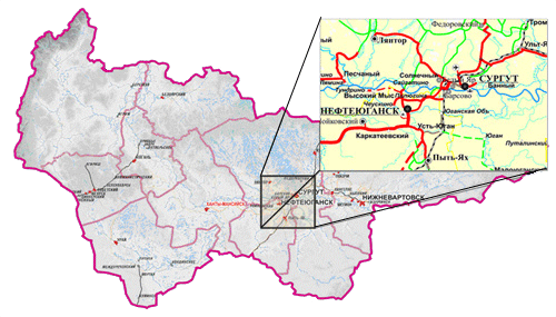
frame content of the pilot project had been determined primarily by territorial boundaries: was selected a plot area of 100,000 sq. km in the Central part of Khanty-Mansiysk Autonomous district-Yugra (near the towns of Surgut and Nefteyugansk), which contains many different objects of the road network, which allowed to visualize the system.
- functional content


