The area monitoring according to the results of space and aerial photography
The area monitoring according to the results of satellite imagery
Ekaterinburg, Metallurgov str. (2006 - 2016)
Remote sensing data of Land every year becoming more affordable and advanced, there are new opportunities and applications of space-borne data.
Based on technologies developed by the specialists of the Department of cartographic monitoring based on remote sensing data, and practical results, industrial units", Uralgeoinform" performs full complex of works with the use of space images:
- Topographic monitoring of territories and objects for solving problems of land, forest, water cadastres, urban planning, territories oil and gas fields, agricultural lands and etc.
 |
 |
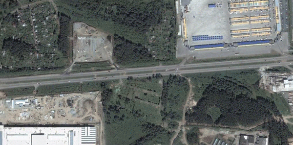
| Monitoring the development of the road network in Ekaterinburg on satellite images QuickBird (resolution 0.6 m) | |
 |
 |
| The planning for the construction of a large shopping complex (left) and the construction of the shopping center "MEGA" (right) at the South-Western outskirts of Yekaterinburg | |
- Creating and updating digital topographic and thematic maps and plans of scale 1: 5 000 – 1: 200 000
 |
Updating of digital topographic maps |
 |
Updating of digital topographic maps |
- The creation of orthophotos and photos
 |
A fragment of the photomaps created by images from Ikonos |
- Construction of digital elevation models
 |
Digital model |
- Creation of a digital three-dimensional models of territories and objects of different levels of detail for visualization of geospatial data
 |
3D model of the city centre of Eekaterinburg, was established on the basis of stereoscopic imagery |
- Methodological support, including: development of normative and technical documentation, consultation on questions of processing and use of satellite imagery, as well as the choice of optimal parameters of satellite images for specific tasks
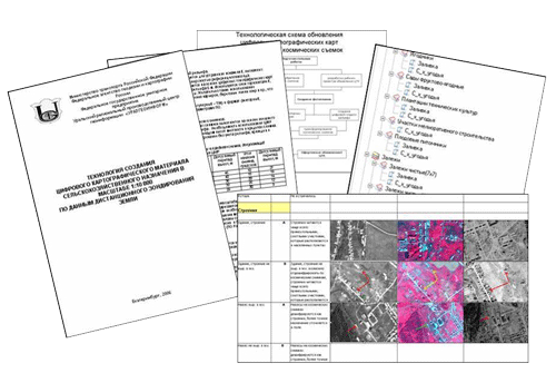 |
The technology of creating maps of agricultural purpose |
Official representation of:
JSC "Uralgeoinform" accepts orders for the supply and processing of all the existing systems of remote sensing (QuickBird, WorldView-1, Ikonos, GeoEye, ALOS, SPOT 5, Rapid Eye, etc.).
In addition, the company accepts orders for the supply of raw materials high resolution imagery on the territory of the Ural Federal district from satellites QuickBird and WorldView-1 .
You can purchase a digital photogrammetric station Photomod for processing of space and aerial photography, as well as training the program.
Cooperation:
The Department of cartographic monitoring ", Uralgeoinform" is carried out in close cooperation with the leading scientific organizations of Russia in the field of remote sensing of the Earth:
- Department of theoretical foundations of radio engineering, Ural Federal University (UFU), Ekaterinburg;
- Department of photogrammetry and remote sensing, Siberian state University of geosystems and technologies (SSUGT), Novosibirsk;
- Of JSC "State center Priroda (Moscow).
The area monitoring according to the results of aerial photography of the area
Production unit "Uralgeoinform" performs full complex of works on creation of orthophotomaps, creation and updating of digital topographic and thematic maps and plans of scale range 1: 500 – 1: 25 000 based on aerial survey data.

A fragment of orthophotomap scale 1:2 000


