Applications of digital elevation models
1. Create predictive spatial models considering the characteristic features of the landscape
-
Calculation of geometric characteristics (area, length, perimeter) taking into account relief for the needs of architecture and urban planning, engineering, cartography, navigation;
-
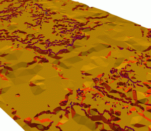
Calculation of the steepness of slopes, monitoring and prediction of geological and hydrological processes e.g., flood zones flood waters for emergency or washout of fertile soil layer for agriculture and more;
 |
Digital terrain model with calculated slopes. The yellow color shows gentle slopes, crimson color is cool. |
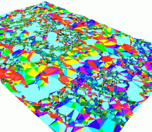
- The calculation of the light and wind conditions for architecture and urban planning, engineering survey, environmental monitoring;
 |
Digital terrain model with calculated exposure of the slopes. Different colors shows the orientation of slopes to the horizon. |
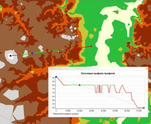
- Building a visibility area for telecommunication and cellular companies, architecture and urban planning;
 |
Built using a digital elevation model profile "line of sight". Green represents visible areas of the profile, the red is invisible |
2. The orthorectification of the materials of aero - and space shooting
 |
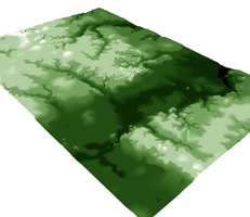
three-dimensional GRID surface |
3. The formation of attributive and geometrical characteristics in the creation and updating of digital topographic maps
The specialists of JSC "Uralgeoinform" developed by technology creation and storage of high-precision digital elevation models in the database "Vault feature".


