Part 2 – Asia
In the previous selection Part 1 - Australia - we presented unique photos of the Earth taken from the space satellite Landsat 7. These images were processed by overlaying visible and infrared data. These pictures are not like our usual photos of the Earth from space. They are more like colorful paintings. In this collection we offer you the colors of Asia.
Such pictures will be processed and "painted" for you by experts Department of digital photogrammetry
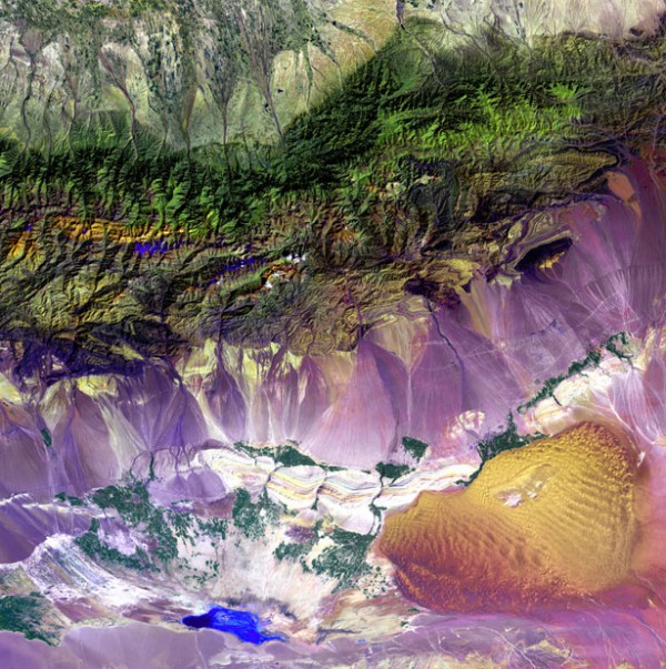
The Bogda mountains in China
Turfan depression, located at the foot of the Bogdan mountains, consists of salt lakes and sand dunes. The Turpan basin is notable for being the deepest in Central Asia and the third in the world after the dead sea basin and lake Kinneret.
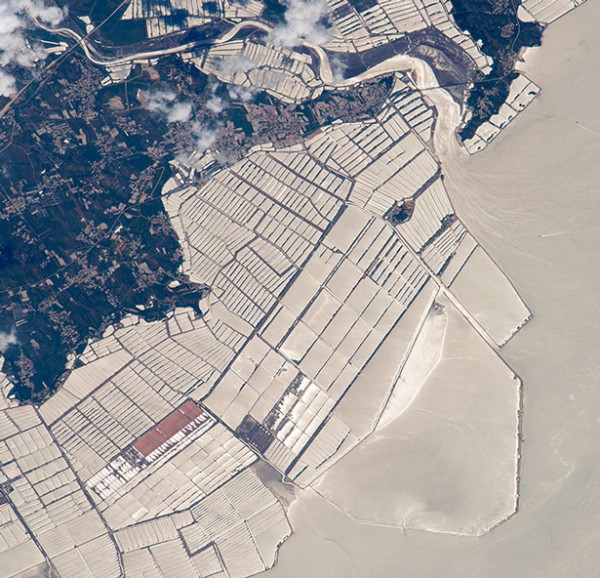
Irrigation system in Northern China
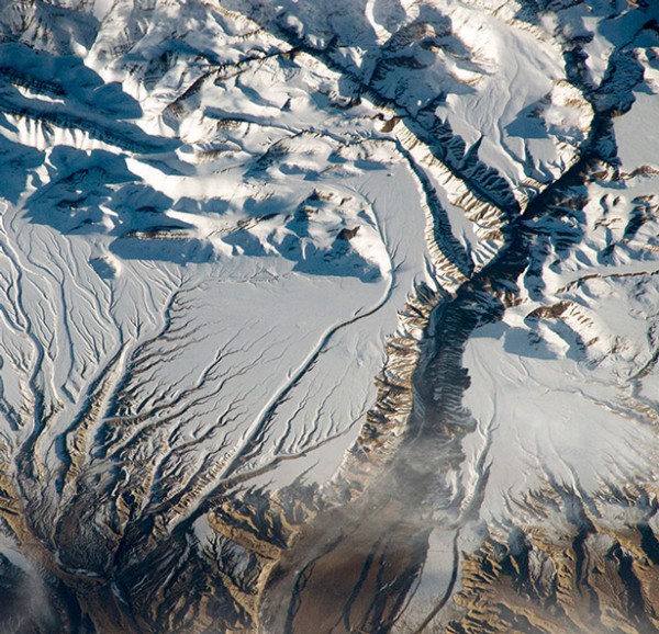
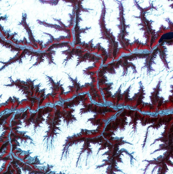
Himalayas
The highest mountain system of our planet – the Himalayas, from space looks like a plateau with small hills.
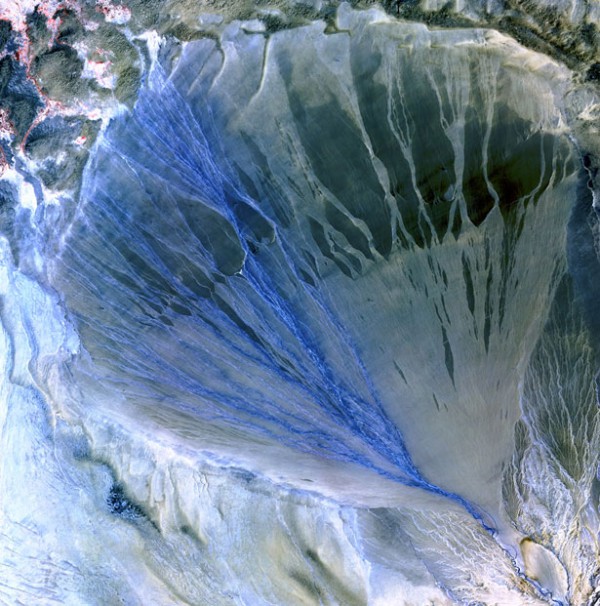
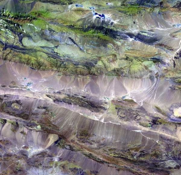
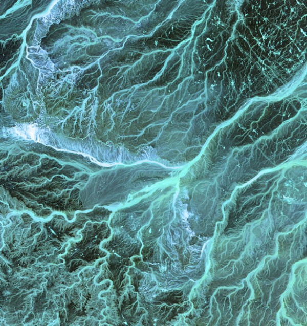
Alluvial cone
An alluvial cone formed between the Online and Kunlun mountain ranges on the southern border of the Takla makan desert in China. Alluvial cones are formed on land, at the foot of the mountains, where the water flow makes the detrital material which is deposited in the shape of a convex half-cone, with its apex directed to the place of removal.
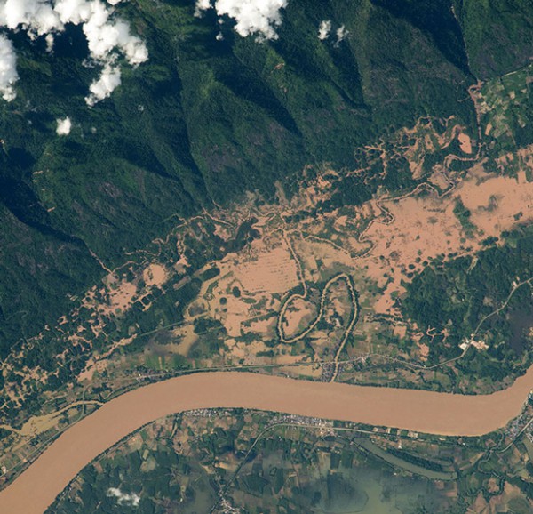
Mekong river
Mekong river (Viet Nam. "River of nine dragons"). Between Thailand and Laos.
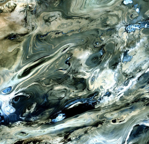
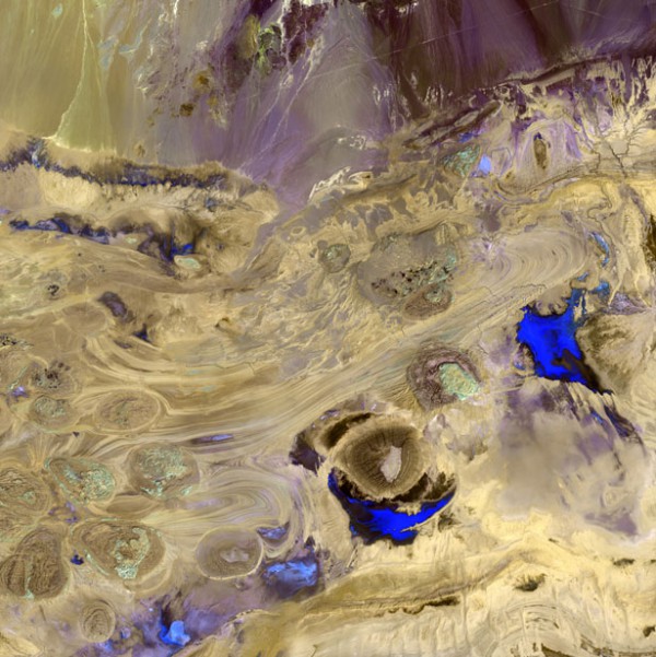
Deshte-Kevir, Iran
Deshte-Kevir (Great Salt desert), is the largest desert in Iran and one of the most lifeless deserts on Earth. The surface of the desert covered with crusts of salt that protect the meager moisture from completely evaporated.
Mongolia
A transitional zone located between the Mongolian steppes in the North and the dry arid desert of Northern China in the South. In the local dialect Edrengiyn Nuruu.
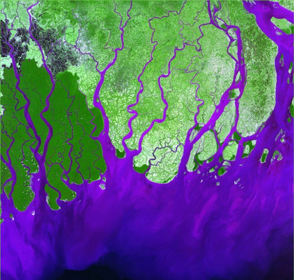
Ganges river Delta
At the point where it flows into the Bay of Bengal, the Ganges river forms a vast Delta. The territory of the Delta is covered with marshy forests, known as Sunderbans, which is home to the Royal Bengal tiger.
The great salt desert, Iran
Shallow lakes and winding valleys of the desert are more like splashes of paint on canvas than a desert landscape. The desert is located on uninhabited territory in Iran.
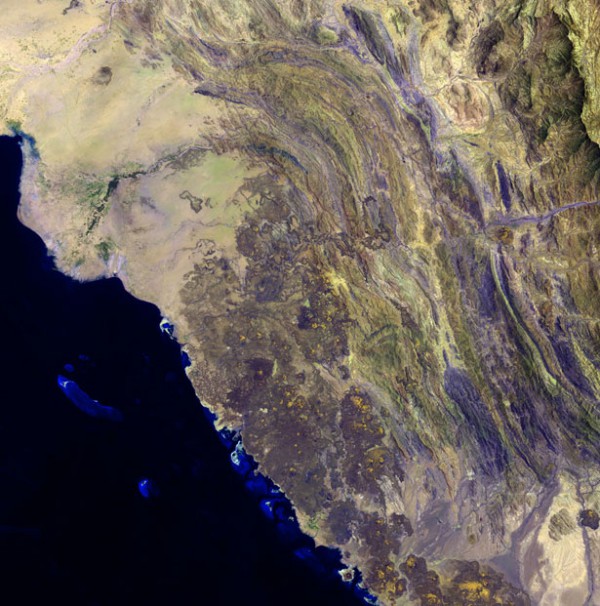
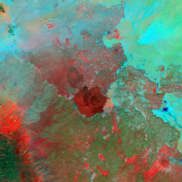
Harrat al Birk, Saudi Arabia
Dark volcanic cones on lava fields formed from eruption of solidified lava along the shoreline of the red Sea are known as Harrat al Birk. Such lava fields are often found in the Arabian Peninsula, their age ranges from 2 to 30 million years.
Himalayas
The mountain system, located between the Tibetan plateau in the North and the Indo-Ganges plain in the South, is 2,900 km long and 350 km wide. Glaciers are located mainly around the largest mountain ranges and the highest peaks.
Jordan
The river network is of Jordan form a deep temporary water streams, flowing only during the winter rains. In summer they dry out or become very shallow.
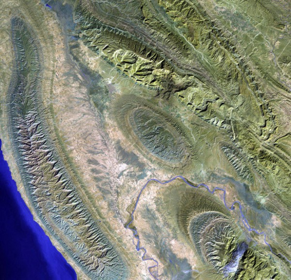
Lake Konari, Iran
A small town in the mountains Of konari Zagros. In the lower left corner – the Caspian sea.
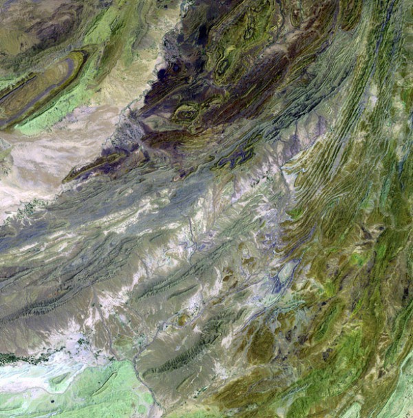
Suleiman mountains, Pakistan
The Suleiman mountains are located in the Pakistani province of Baluchistan and in the Afghan province of Zabul. The length of the mountains is about 600 km.
Syrian desert
The Syrian desert is a desert in the middle East, between the Euphrates river valley and the Eastern Mediterranean coast. It is located on the territory of Syria, Jordan, Iraq.
Such pictures will be processed and "painted" for you by experts Department of digital photogrammetry
Space images – NASA, Us geological survey.
oakhill.ru, photolium.net

