Dear colleagues!
We invite you to take part in the largest geophysical conference in Russia! Our goal is to create an interdisciplinary training ground for exchange of experience and information, for a few days to join the market leaders for demonstration of domestic and foreign innovative scientific and industrial developments in the field of geodesy, surveying and aerial photography.
At the conference you can get acquainted with innovations of domestic and foreign developers in the field of technologies, equipment and software for collecting and processing geospatial data, discuss the prospects of development of the market, learn about programs of training and retraining of industry experts, visit master classes of leading companies, to communicate with colleagues in an informal setting.
Date and place of the conference: February 16-17 2017, Moscow, Novotel Centre
The conference takes place in the following thematic areas:
- Geodesy: tools, software, technology
- Digital aerial photography and photogrammetry
- Laser scanning and data processing
- Unmanned aerial vehicles for mapping and monitoring
- Remote sensing and satellite monitoring of the Earth
- Satellite navigation and geodetic systems
- Cloud storage and cloud processing
- Geographic information systems and BIM
- Surveying
- Offsite manufacture
- Metrology, standardization and certification
- Education in the industry
- The Economics of the industry
Conference organizers:
- International Federation of Surveyors (FIG)
- International Union of mine Surveyors (ISM)
- JSC "Roskartografiya"
- Association of professional companies in industry of unmanned aircraft systems
- Moscow State University of Geodesy and Cartography (MIIGAiK)
- National research Irkutsk state technical University (ISTU)
При активном содействии:
- Association of professionals of topographical service
- Russian society of assistance to development of photogrammetry and remote sensing (RFDS)
- Union of surveyors of Russia
The participants of the VII International scientific-practical conference
"Geodesy. Surveying. The aerial photo. At the turn of the century"!

On behalf of the group of companies JSC "Roskartografiya" greetings to all potential participants of the VII International conference "Geodesy. Surveying. The aerial photo. At the turn of the century”!
Today one of conditions of creation of innovative economy is, including the effective use of the results of geodetic and cartographic activities.
It is very important that the international Conference that will be held for the seventh time, becoming more and more significant event in the field of geodesy, cartography and remote methods of studying the Earth.
The participants of the Conference will be a wonderful opportunity to get acquainted with the latest developments in the field of surveying equipment, technology for the collection and processing of geospatial data, with the main tendencies of development of the market of geoinformation technologies in Russia and abroad.
I am convinced that the Conference will be held in a constructive and creative atmosphere, the participants will gain new knowledge and exchange experience, and decisions will have great practical value and will contribute to the development of international and interregional cooperation in the field of geodesy, cartography and remote methods of studying the Earth.
I want to note that enterprises of group of companies JSC "Roskartografiya", with significant scientific production and personnel potential, is always open for constructive cooperation and interaction.
I wish the organizers, participants and guests of the Conference successful and efficient operation, implement your solutions, ideas and developments in the interests of our common cause – the geodesy and cartography!
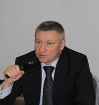
D. M. Krasnikov,
General Director of JSC "Roskartografiya"
Read more: con-fig.com


