Services
The practical results of the work
The practical results of works performed with the use of satellite imagery:
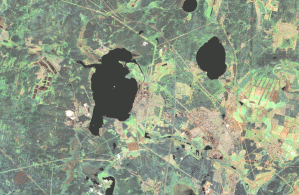
- Updated digital topographic maps of scale 1: 200 000 on the territory of the Ural Federal district (314 item leaves, the images Landsat 7);
 |
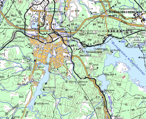 |
| Updating of digital topographic maps of scale 1:200 000 on the territory of Sverdlovsk region on satellite images Landsat 7 (resolution 15 m) | |
-
Updated digital topographic maps of scale 1:100 000 on the territory of oil and gas fields of the Yamal-Nenets Autonomous district (item 11 sheets, the images Spot 4);
-
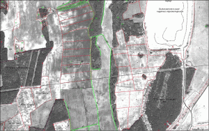
Created digital maps for agricultural purposes scale 1:10 000 in the southern part of Sverdlovsk region (56 nomenclature sheets of images of the Spot 5);
 |
|
A fragment of a digital map of agricultural purpose of the scale 1:10 000 |
- Created and updated digital topographic map Sredneuralsk, Sverdlovsk region, scale 1:10 000 (for QuickBird images);
- Created and updating of digital topographic maps of 1: 25 000 scale for districts of the Yamalo-Nenets Autonomous Okrug (77 nomenclative sheets),
- Khanty-Mansiysk Autonomous Okrug – Ugra (604 nomenclative sheets);
- Created and updated orthophotos digital topographic maps of scale 1:5 000 in the areas of oil and gas fields in KHMAO – Yugra and YNAO (4500 nomenclative sheets, the images QuickBird);
- In 2008 satellite imagery QuickBird and Ikonos updated digital topographic map on the territory of the municipality "Eekaterinburg", scale 1:10 000, format Ingeo, 2009 updated formats view and MapInfo;
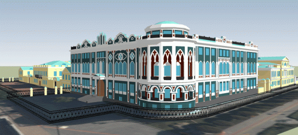
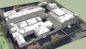
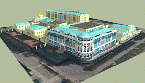
- In the framework of experimental works created digital three-dimensional terrain model of separate sites of Eekaterinburg for the stereo pair of images Ikonos (the source is stereo pair of images Ikonos);
 |
|
 |
 |
|
3D model - the House of Sevastyanov, the Administration of the Governor of Sverdlovsk region, |
|
- On satellite images (Spot 2.5 m and 0.6 m QuickBird) created digital orthophotomaps in 1: 25,000 scale for the purposes of the cadastral division into a number of districts of the Republic of Bashkortostan;
- Updated digital topographic maps of scale 1: 25 000 cities: Kamensk-Uralsky (QuickBird 0.6 m), Verkhnyaya Pyshma (Spot2,5m), Khanty-Mansiysk (Alos 2.5 m), Nizhnevartovsk (Alos 2.5 m), Novy Urengoy (Alos 2.5 m), Surgut (Alos 2.5 m), Urai (Spot 2,5 m), Nyagan (Cartosat–1 2.5 m), Noyabrsk (Alos 2.5 m), Kogalym (QuickBird 0.6 m), Petukhovo (Alos 2.5 m) and others;
- According to the materials of satellite imagery (Alos 2.5 m) updated digital topographic maps of scale 1: 25 000 on the territory of the Central part of the KHMAO–Yugra (1236 nomenclative sheets);
- Landsat7 imagery on the territory of Sverdlovsk region created orthomosaic;
- Imagery ALOS AVNIR on the territory of the Khanty-Mansiysk Autonomous Okrug – Ugra created orthomosaic;
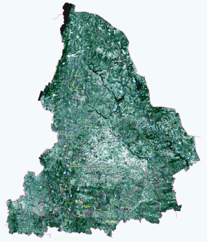 |
| Orthomosaic on the territory of Sverdlovsk region |


