GIS for social-hygienic monitoring
JSC "Uralgeoinform" performs preparation of the GIS social-hygienic monitoring of various territories and municipalities.
The use of advanced software combined with high qualification of our specialists allows to implement projects of any complexity and industry trends, including social infrastructure and sanitary nature in Eekaterinburg, Sverdlovsk region and other regions of Russian Federation
The purpose of this kind of GIS projects in "Uralgeoinform" is the formation of a complex of measures for methodical and information and analytical support for solving a number of environmental, social and health problems in specific localities.
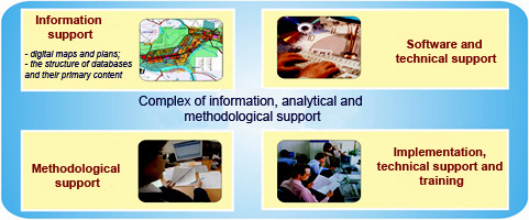
Among the components of this complex:
- Provision of information, including digital mapping, structuring of the database and initial filling;
- Software, technical and methodological support;
- Implementation, training and support.
Territorial GIS for social-hygienic monitoring
The project of geoinformation system of socio–hygienic monitoring (GIS "SHM") is JSC "Uralgeoinform" since 2001 within the framework of public contracts by order of the Administration of Rospotrebnadzor in the Sverdlovsk region.
The purpose of the project is the creation of a complex for information-analytical and methodological support of the tasks of medico-ecological and socio-hygienic monitoring.
Components of the complex:
1. Digital maps and plans
- Created and updated digital city plans in scale 1:10000-1:25000.
- Thematic maps that reflect the status of their territory in various directions of the analysis of socio-hygienic monitoring.
2. The structure of the Central repository
A relational database for the given primary data on the state of the environment (drinking water, air, soil, food), number and morbidity of the population, as well as some of the estimated parameters. The repository structure based on the content of approved forms of primary data: observation protocols, statistical forms and other types of reporting. All vault credentials are temporal (time of receipt) and personalized (taking into account the source of income).
3. Initial filling
Background: the international classification of diseases, lists of substances and parameters, the reference allowable concentrations and other information that allow for a consistent a consistent accounting of the primary data.
GIS software "SGM" version 1.7 is represented by the following subsystems and components:
1. The subsystem of input and editing of primary data
The subsystem is designed for distributed data access the regional information Fund of the monitoring and includes the following modules: "Reference", "Air", "Soil", "Water", "food", "Man"
2. The subsystem of formation of the registry queries
The subsystem includes the following modules:
- "Air:" the calculation of the controlled indicators of pollution (APC, API, etc.) and form a reporting forms for air quality
- "Soil:" Calculation of controlled indicators of pollution (CC, Zc, Bn, etc.) and formation of reporting forms according to the condition of the soil.
- "Water:" Calculation of the monitored pollution indicators (W common etc.) and form a reporting forms as drinking water.
- "Food:" calculate the controllable parameters and the formation of reporting forms for food safety and balanced nutrition.
- "The size and incidence" Calculation of controlled numbers and somatic morbidity, comparative analysis of the territories and the formation of consolidated reporting forms for the health status of the population.
3. Subsystem import
Automation of processes of gathering and collating data from various departments in the regional information Fund of social-hygienic monitoring.
4. Mapping subsystem
The main objectives of the cartographic subsystem is spatial positioning of SHM (observation stations, sampling points, addresses, etc.) and creating spatial queries to select the data a Central repository of regional information Fund of the SHM.
5. Subsystem spatial analysis
The subsystem is designed to display the results map and register spatial queries to the calculation of controllable parameters. The subsystem includes the following modules:
- "Ranking" Color gradation of territories in accordance with the values of integral indicators.

Map of distribution of average area concentration of specified substances in atmospheric air
- "Map of the dispersion" Modeling continuous fields values of this indicator. The result is a gradation of color regions separated by the contours lines.

A map of the distribution of the annual average concentrations of specified substances in atmospheric
the air on the territory of the given municipal formation
1. System analysis
The results of a system analysis of processes of socio-hygienic monitoring. The analysis for divisions of Rospotrebnadzor of the Sverdlovsk region, includes recommendations for the effective application of the geographic information system for the collection and analysis of data in the framework of social-hygienic and medico-ecological monitoring.
2. Rules of digital description of spatial data
Documents describing the rules of classification and the visual design of the spatial data used for the needs of socio-sanitary and medico-ecological monitoring.
The specialists of JSC "Uralgeoinform" is technical support and the training to operate the system.


