Subsystem "Archive"
Information system designed for collection, storage and accounting of finished goods. The system was developed by specialists of information-analytical center within the creation of geoportals Federal district.
The information system "Archive" is recommended for implementation in large enterprises operating in the field of digital cartography.
The system allows you to store and describe the following types of information:
- vector and raster maps, source
- satellite imagery, orthophotos
- digital elevation models
- any supporting materials (reports, contracts, classifiers and libraries of conventional symbols).
Advantages of the system
- Reliable data storage
- Increasing the speed of access to enterprise resources
- Search optimization and evaluation of products and materials
- A visual representation of the state information resources of the enterprise
- Optimization of expenses for accounting and inventory of products
- Preparation of various reports
- Informing consumers about products and its prompt provision
- Centralized system administration and information security management
- Support for international standards for the storage and structuring of data
- Communication and joint efforts on formation of the Russian spatial data infrastructure
System functions:
- Data storage (zip the project files for vector data geotiff format for raster data);
- Loading and unloading data. A graphical representation of the data downloaded as images for preview ("preview");
- Maintenance and effective use of reference information about data–meta information
All loaded into the system, the spatial data are accompanied with additional information (customer, performer, data relevance, data quality, year of creation and so on)
- Documentation of operations performed on database systems "Archive"
- Preparation of reports in accordance with prescribed forms
- The distinction between access to information (subject to the powers and functions of the user
- Centralized system administration and information security management
To install the archive requires the following software:
-
ORACLE 11 g Standart Edition
-
MapViewer Ver11_B091229.
On the client workstation sufficient to have a Internet browser.
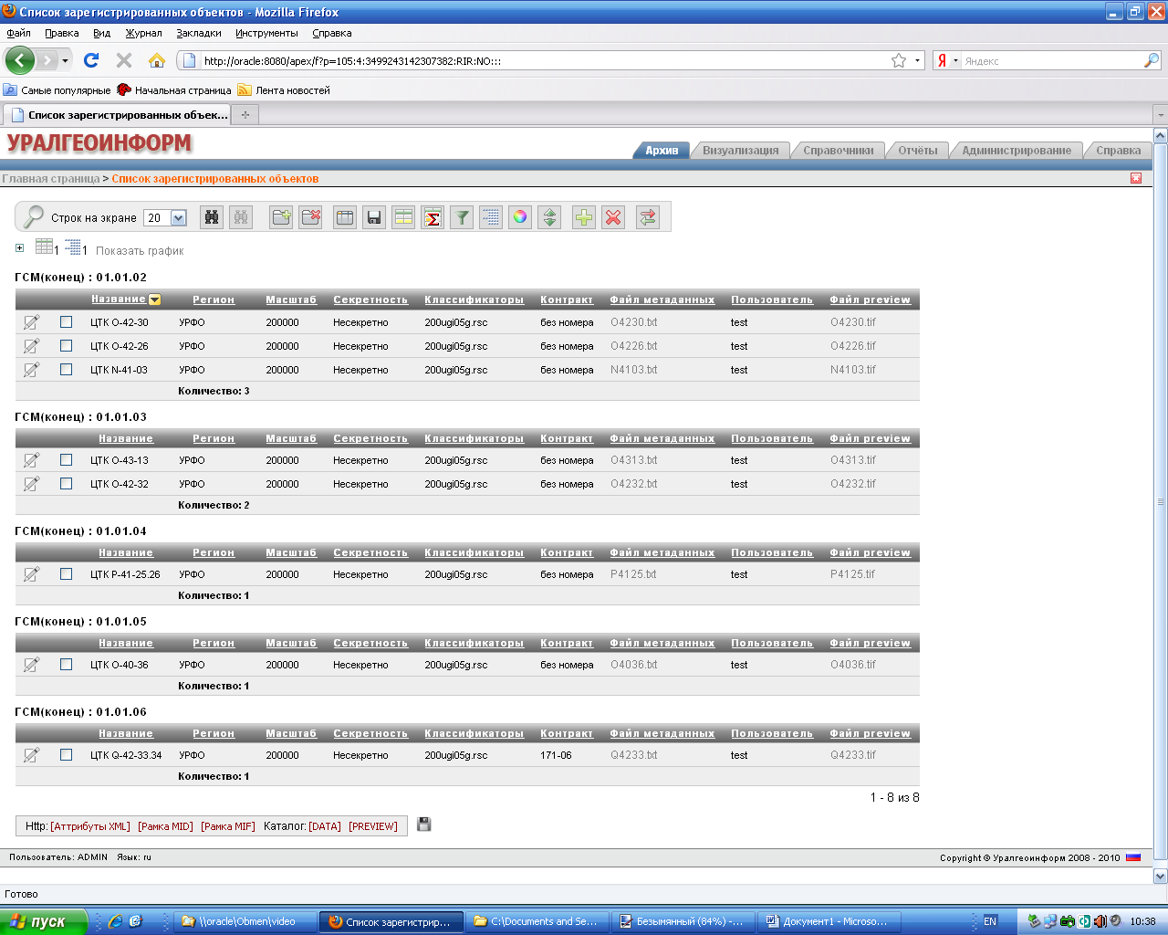
Displaying data
Table selected for display units is formed dynamically. Its appearance is determined by:
- selection criteria (search) units,
- the specified structure of the table of results
- the selection of the principle of sorting rows,
- settings backlight (color highlight) the rows and/or columns
- the maximum number of table rows on a single screen.
Check object
This section contains a form that allows to describe the object (recorded in the database meta-information): name of the object, scale, format, year of creation and so on.
Upload metadata about the storage unit is available in the following formats: XML, and MID/MIF.
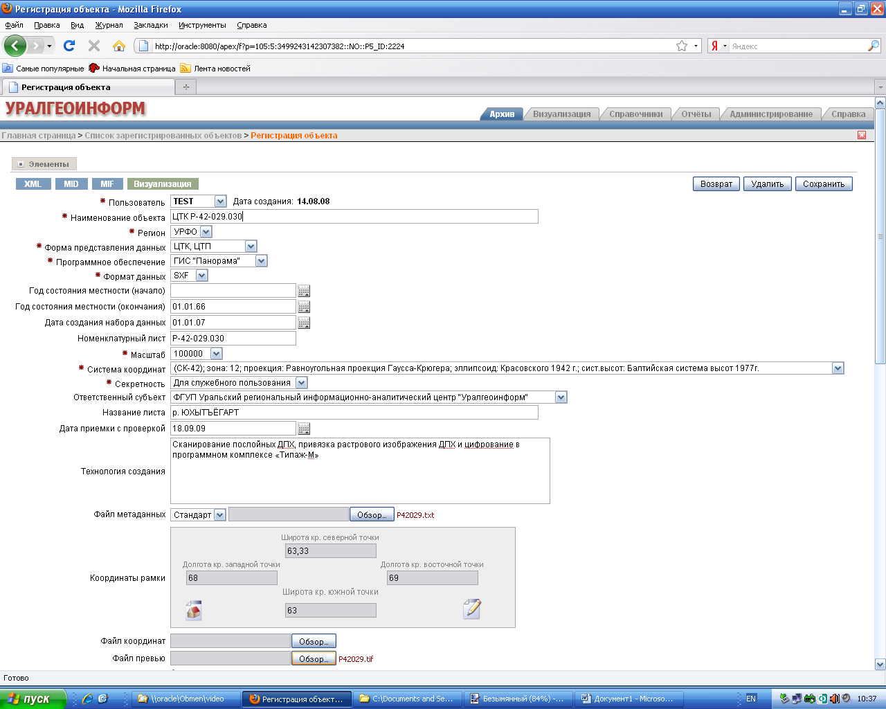
Click on the white button "Visualization" allows you to shift from editing and check in the section of visualization.
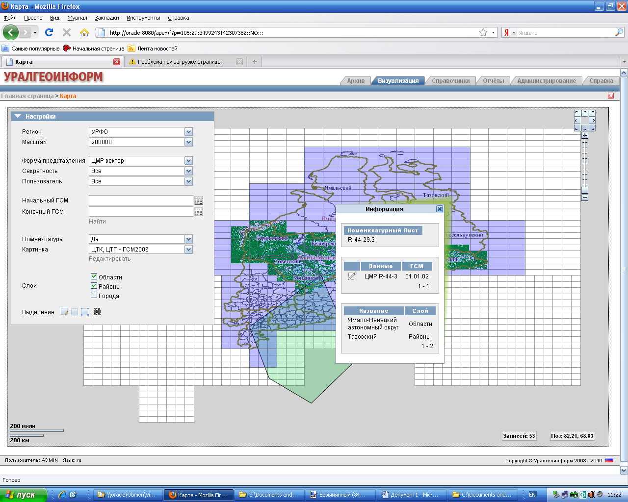
The information system provides the function of data visualization. The user selects the required settings of the map (region, scale, range, layers, etc.). The result of this selection is displayed on a blank map (cartogram is built). Every storage unit is displayed with a solid fill. To get help about a particular storage unit, you must place the cursor on the field map and click the right mouse button.
Provides reverse function. The system allows the cursor to highlight the area of interest and to receive (in the form of tabular data) information about stored objects that belong to this region
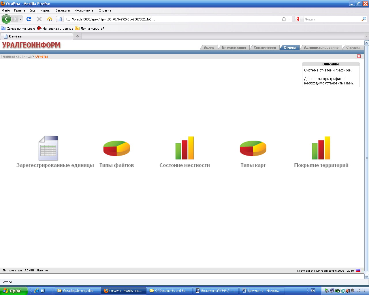
To systematize and analyze data provided feature preparation of reporting materials on the content of "Archive". The system generates the following types of reports:
- Registered units (table)
- File types (pie chart)
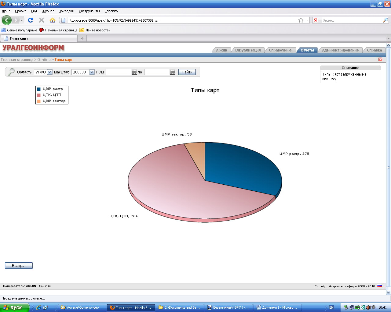
- Map types (pie chart)
- The status area (the bar chart)
- Coverage of territories (table).
The reporting data can be viewed not only on screen but also print.
|
|
 |
|
|
report types |
an example of plotting the "map types" |
For the convenience of users and facilitate the establishment of information about objects (meta-information), a system of reference. This section brings together all existing information in the system directories.

Created and operates an informational section that allows the user to better navigate in the system.
The information system provides the following administration tools:
- User management (adding, deleting users, assigning roles)
- Roles (access control)
- Regions (list of regions)
- Item grid
- Layers
- System settings
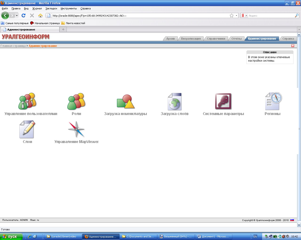
Screen-specific administration tool, accessed by clicking the appropriate icon on the Administration tab.


